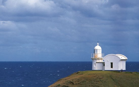
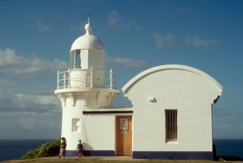
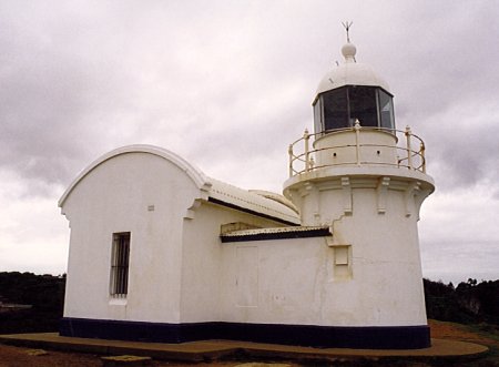
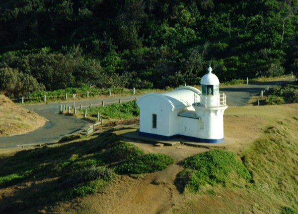
Tacking Point Lighthouse
Tacking Point is one of five similar NSW lights designed by Colonial architect James Barnett who held this role for 25 years from 1865 to 1890. Taking Point was established to serve the growing Port Macquarie.
History
In the early to mid 19th Century the main contact for the coastal towns of the north coast of New South Wales was sea transport. There were no roads and the railways were only just beginning.
There were few lights and in the Tacking Point area more than 20 wrecks occurred, the first being the schooner Black Joe in 1823, and the steamer Sumatra in the same year.
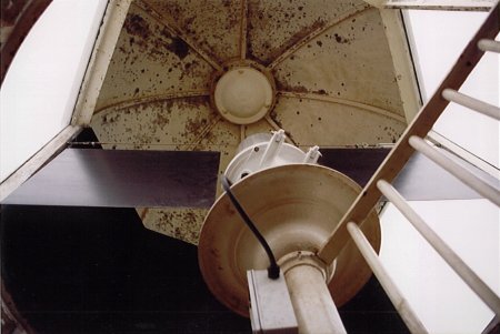
In 1879 a fixed 4th order catadioptric light of approximately 1000 candelas was erected on Tacking Point. The structure is built of cement-rendered bricks and because of the elevation only needed to be 8 metres high.
The apparatus was converted from wick burner (kerosene) in 1919 to automatic acetylene operation. As a result of automation the keepers were withdrawn after 40 years of service. The light was converted to mains electricity in 1974. Conversion to LED light source was completed in early 2021 with the removal of the rotating VRB-25 beacon and installation of a fixed high intensity LED beacon.
The foundations of the keeper’s cottage can still be seen.
continued below …


© All images are copyright of their respective photographers and are not to be used without permission.
| Title | Address | Description |
|---|---|---|
Smoky Cape | Lighthouse Rd, Arakoon NSW 2431, Australia | |
Tacking Point | Lighthouse Rd, Port Macquarie NSW 2444, Australia | Tacking Point |
Crowdy Head | 1 Elizabeth St, Crowdy Head NSW 2427, Australia | Crowdy Head |
continued from above …
Keepers
We need your help in compiling a list of keepers for this lighthouse. If you have any information then send it to keeper@lighthouses.org.au.
Please include this lighthouse’s name, the keepers full name and what years they were keepers. Also include the same information for any other lights they were on.
Technical Details
| First Exhibited | 1879 |
| Permanent Tower | 1879 |
| Current Tower | 1879 |
| Status | Active |
| Location | Lat. 31° 28.7 S. Longitude 152° 56.2 E. |
| Original Optic | Chance Bros 4th order Fixed catadioptric |
| Current Optic | Sealite SL-300 single tear high intensity LED beacon |
| Automated | 1919 |
| Demanned | 1920 |
| Construction | Cement-rendered Bricks |
| Height | 8 m |
| Elevation | 34 m |
| Range | 16 NM |
| Character | Grp. Fl. (4) W 20 secs |
| Intensity | 12,800 cd |
| Light Source | High efficiency LED's |
| Power Source | Mains Electricity, battery backup |
| Operator | NSW Transport Maritime Services |
| Custodian | NSW Department of Industry Crown Lands |
| Notes | FA-251 rotating beacon replaced 2021 |
NB: Information is historical data and is not for navigational purposes.
Access
The lighthouse reserve is open all year. Access via Lighthouse Road just south of Port Macquarie. The tower is closed to the public.
Tours
No
Accommodation
No
Museum
The Mid North Coast Maritime Museum has some lighthouse artifacts.
6 William Street, Port Macquarie NSW
Associated Lighthouses
Clarence River Lighthouse (old tower demolished)
Sources
- Annette Flotwell for Photograph
- Brian Lord for Photographs
- Cyril Curtain for Photographs
- Ian Clifford for Photographs
- Winsome Bonham for Photograph
- Averil Legg
- Dept of Transport
- From Dusk Till Dawn by Gordon Reid
- Mary Shelley Clark and Jack Clark
- Sydney AFLOAT
- W. Lippingwell, Coastal Lighthouses of NSW, 1938